






 LATEST ART BOOKS
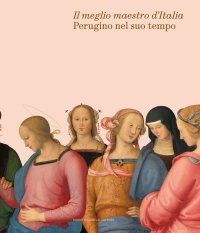
Perugino e il Suo Tempo. "Il Meglio Maestro d'Italia"
Perugia, Galleria Nazionale dell'Umbria, March 4 - June 11, 2023.
Edited by Picchiarelli V. and Pierini M.
Milano, 2023; bound, pp. 592, 650 col. ill., cm 24x21.
cover price: € 40.00
|
Books included in the offer:
Perugino e il Suo Tempo. "Il Meglio Maestro d'Italia"
Perugia, Galleria Nazionale dell'Umbria, March 4 - June 11, 2023.
Edited by Picchiarelli V. and Pierini M.
Milano, 2023; bound, pp. 592, 650 col. ill., cm 24x21.
FREE (cover price: € 40.00)
Michele Rocca e la pittura rococo a Roma
Brescia, 2004; bound in a case, pp. 310, b/w and col. ill., tavv., cm 24,5x31,5.
FREE (cover price: € 180.00)
Cucinare per gli amici
Translation by S. Mancuso.
Milano, 2012; clothbound, pp. 269, ill., cm 21x26,5.
(Gli Illustrati).
FREE (cover price: € 29.90)
Sicily Aeolian, Egadi, Pantelleria, Lampedusa Islands Malta
Luca Tonghini
Edizioni Il Frangente
English Text.
Verona, 2023; paperback, pp. 180, col. ill., cm 21x29.
ISBN: 88-3610-174-7 - EAN13: 9788836101740
Languages: 
Weight: 1 kg
This pilot and its 130 user-friendly charts show all of the available harbours, marinas and anchorages within this cruising area.
The introduction includes a table with distances and the main routes, a list of useful charts, as well as local weather information.
The entire area is divided into six chapters. Each one has its own quick guide that includes waypoints, harbour and marina facilities (e.g. water and electricity, fuel, repairs, etc.). At a glance, you will be able to decide where to head based on your yacht and the weather. Each chart has an icon that shows the harbour or bay position within the navigation area. This way you will always know exactly where you are.
This guide comprises numerous plans for harbours, marinas, bays and anchorages, each with a wealth of practical symbols and overviews providing complementary information to pilotage notes so that you can sail with peace of mind. A handy wind-rose icon gives wind direction and exposure for each plan.

Pietro Bellotti Detto Canaletty. Un Vedutista Veneziano nella Francia dell'Ancien Régime
Officina Zanon 1946-2026. 80 anni di sapere artigiano-80 Years of craft knowledge. Ediz. bilingue

Conte e Mattarella. Sul palcoscenico e dietro le quinte del Quirinale. Un racconto sulle istituzioni
